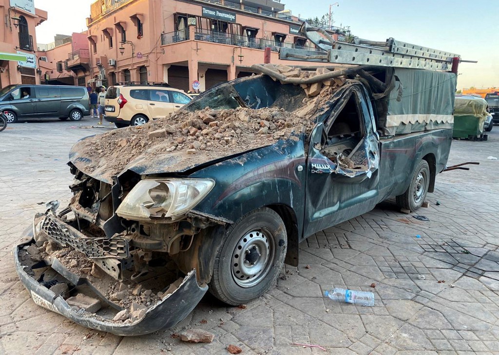
The number of fatalities in a 6.9-magnitude earthquake in Morocco has risen to 632, the Medias24 portal said citing the kingdom’s Interior Ministry.
Another 329 people were affected, according to the portal.
Friday night’s earthquake is the deadliest Morocco has endured since the Al Hoceima earthquake of 2004, which happened in the early hours of 24 February near the Mediterranean coastal city.
It had a lower magnitude, at 6.3 compared to last night’s 6.8, but still killed more than 600 people injured more than 900. Up to 15,000 people were left homeless.
The deadliest and most destructive earthquake in Morocco’s history came on 29 February 1960.
It happened near the city of Agadir on the country’s western shore, killing more than 12,000 people leaving at least 35,000 homeless.
It had a relatively moderate magnitude of 5.8, but its shallow depth, proximity to Agadir, and the quality of building construction in the city made its impact devastating.
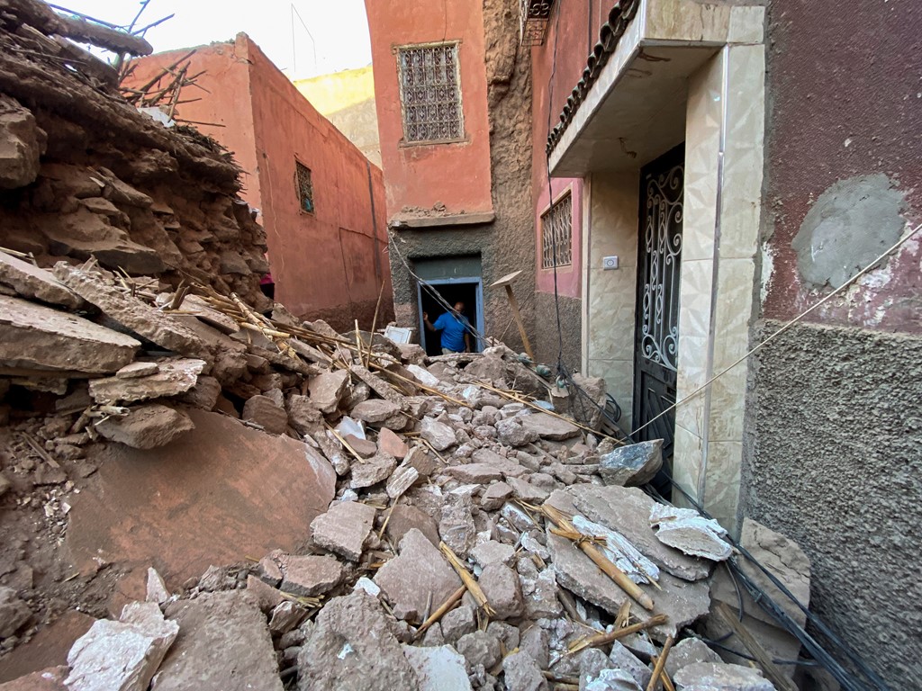
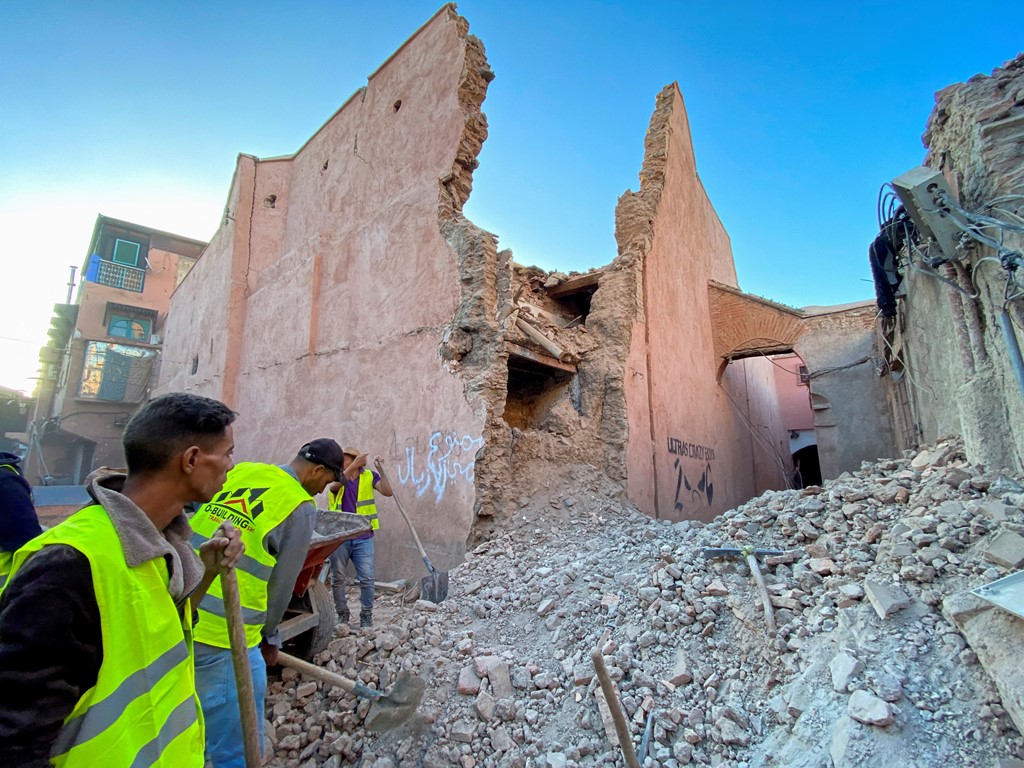
The quake promoted changes in Morocco’s construction rules, but many buildings – especially rural homes like those worst hit on Friday night – are not built to withstand such tremors.
The tremors of Friday night’s earthquake in Morocco were felt within a radius of 400 km from its epicenter.
“The earthquake, the epicenter of which was in the municipality of Igil, 80 km southwest of Marrakech, was felt in Moroccan cities within a radius of 400 km,” Nasser Jabour, head of the department at Morocco’s National Geophysical Institute, told the Maghreb Arabe Press news agency.
The size and shallow depth of the Morocco earthquake means it’s likely to have caused damage across a wide area.
According to the US Geological Survey (USGS) the 6.8 magnitude earthquake was just 11 miles below the surface.
The epicentre was in the High Atlas Mountains near Oukaimeden, around 50 miles south of Marrakech.
It’s a sparsely populated area with Amazigh, or Berber, villages.
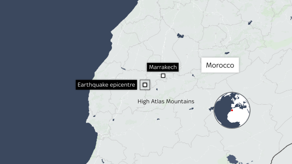
Houses are traditionally built with mud bricks and may not have withstood the shaking. There’s also a risk of landslides on steep slopes.
The location is within the African tectonic plate, around 350 miles south of the boundary with the Eurasia plate that Europe and much of Asia sit on.
The two plates are moving around 24mm a year relative to each other.
The USGS say earthquakes on what’s called a reverse fault usually involve a slip over an area of around 20 miles long by 12 miles wide.
With agency reports